At the network level, EMME/2 is using the centroid approach for representing the origin destination zones. This means that each zone corresponds to a specific node, called centroid, which is connected to the physical network by means of connector links. While this approach fits very well with the planning models used in EMME/2, there are cases where, at the representation level, it would be preferable to represent each zone by the surface it actually covers, i.e. by using a polygonal representation of the zone instead of a single point.
This polygonal representation is not a part of the EMME/2 data base, but, using the annotation interface and the generalized macro processing introduced in Release 3.0, it is possible to combine the EMME/2 zone data with an external geographical data base and display the resulting plots within EMME/2. This framework is general enough to interface EMME/2 with almost any external geographic information system (GIS), but it requires the preparation of specialized macros and conversion utilities which depend on the system used.
During the past year, INRO has developed a tool specially designed for the graphical display of zone data in the form of polygonal representations within EMME/2 and STAN (INRO's new freight transportation modelling system). This tool is not part of the EMME/2 system per se. It consists in a set of macros and utilities which allow the user to combine zone data from an EMME/2 data base with an external zone boundary data set to produce polygon based EMME/2 plots, such as the two examples shown below.
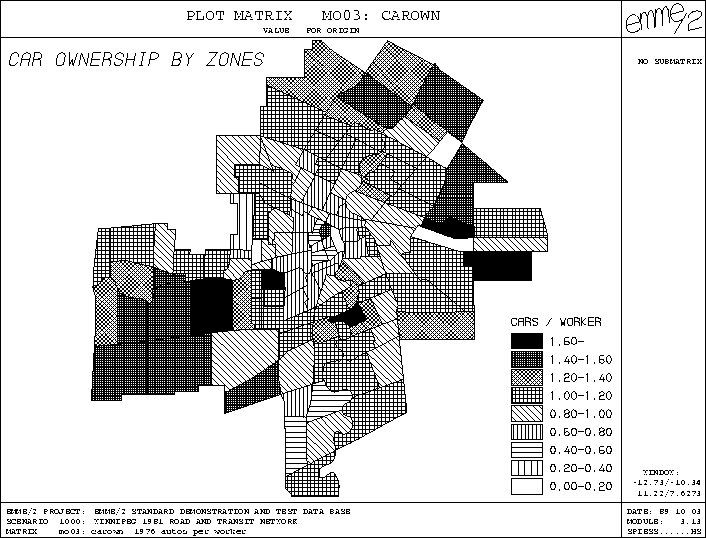
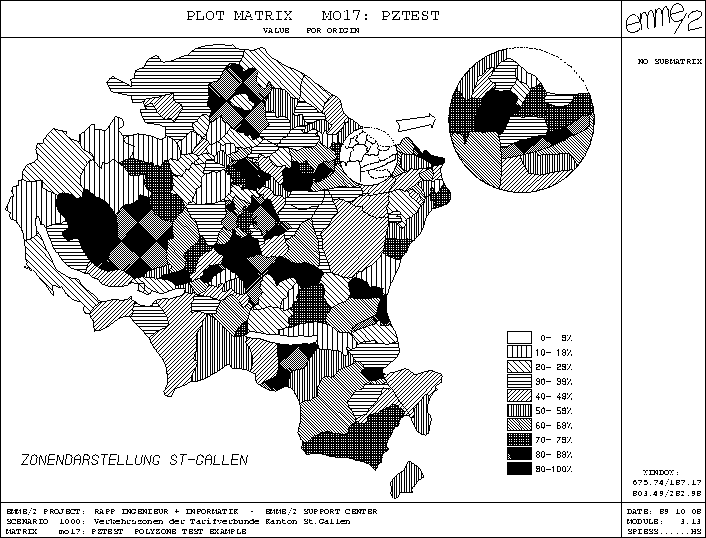
Since this tool uses an approach based on generalized polygons (so called golygons), the zones are not limited to simple polygons, they may well be composed structures, made up of any number of several non-connected components (islands) and contain cavities, such as enclaved zones or lakes.
This tool, initially designed for our internal use, has obtained a lot of attention by EMME/2 users wishing to incorporate this kind of feature into their EMME/2 application. For this reason, INRO is now offering this functionality in the form of a service called POLYZONE, which is available to all EMME/2 users.
Since the setting up of the zone boundary data base for an application is a) quite specialized work, b) requires special hardware and c) is usually done only once for an application, it would not be efficient for each user to digitize and prepare his data set on his own. This work is done much more efficiently by specialized service centers who, based on a zone map, will digitize the zone polygons, set up a consistent zone boundary data set and send it back to the user, along with the necessary macros and utilities.
Once the POLYZONE utilities and the data set for the specific application are installed, the user has access to the following features:
Currently, the POLYZONE service is available from INRO and the EMME/2 Support Center. The fee for the POLYZONE service is based on the complexity of the zone system. The right-to-use for all utilities and programs delivered with the POLYZONE data set is covered by your EMME/2 software licence, i.e. no separate licence fee is levied.
If the idea of POLYZONE sounds interesting for your application, please contact us for more information at the addresses given on page 2.